Colombia is making steady and considerable progress on poverty reduction. The multidimensional poverty rate, which includes quality of life factors like work and access to services, had nearly halved between 2010 and 2019 (from 30.4 percent to 17.5 percent). However, there are vast and persistent inequalities between urban and rural areas. The rural poverty rate has stubbornly stayed at over double the levels seen in urban areas over this period and in 2019, this was a rate of 34.5 percent compared to 12.3 percent.
There are many factors that contribute to higher poverty rates in rural areas in Colombia. For example, there is a higher prevalence of informal work in rural communities, which tend to be dominated by indigenous and ethnically diverse groups. Illiteracy and low educational achievement are also more likely. Meanwhile, water access, waste disposal, and building materials are less adequate.
Understanding and measuring different factors contributing to poverty is critical to effective poverty reduction strategies. Researchers argue that poverty reduction policies should pay explicit attention to improving non-income indicators of poverty, which show slower progress. Colombia’s National Administrative Department of Statistics (DANE) started measuring the multidimensional poverty index in 2010 using surveys. Since then, it has been a champion in the region for timely poverty estimates, imparting their experiences to other countries.
However, data was still lacking for municipalities that were vastly different from those surveyed, disaggregation was limited, and there were untapped opportunities to use non-traditional data sources. In particular, the use of satellite imagery, combined with big data techniques and Bayesian statistics for predictive modelling, can be effective in measuring poverty at high levels of disaggregation and provide insight into other variables connected to poverty.
In other words, it’s possible to build a model to estimate poverty using Earth observations and other big data, that is validated by surveys and expanded to estimate poverty in areas with no data. This means it is possible to produce regular, disaggregated poverty measures for municipalities and their geographical sub-areas. This helps policymakers understand the full picture of people’s lives, instead of solely depending on the census carried out every 10 years.
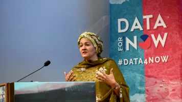
This is where DANE focused its efforts at the Data for Now inception workshop, which took place in November 2019 and brought together over 50 stakeholders from the international data for sustainable development community. During the workshop, DANE explored methodological approaches, identified partners, and began drafting a work plan to produce annual poverty estimates disaggregated by poverty type, geography, and population group.
Since the workshop, DANE, Cepei, and the Global Partnership hosted a technical workshop and meetings with local experts to help improve geographical analysis capacities to measure poverty estimates, with a focus on Earth observations. During the technical workshops sessions, participants assessed different methodologies in the context of data cost, availability, quality, capacity, AI applications, Earth observations analysis, and more. This narrowed down the list of potential approaches, leaving a handful of methods to be tested over the next year relying on non-traditional data sources, Earth observations, administrative data, and surveys. DANE will measure poverty in the country's Pacific region, which has some of the highest poverty rates, later this year and in 2021 using methodologies learned in the training.
While there are obstacles to overcome, like regular access to satellite imagery, technological limitations, and quality assessment of estimates, these are common problems that other Data for Now countries face. The experiences at DANE will help pave the way for scaling quality poverty estimation using non-traditional sources to other Data for Now countries and beyond. Stay tuned.


